A cultural map might show dozens of points around a city centre while another neighbourhood looks empty. Does the second have no cultural activity? Not necessarily: the map may cover one category, rely on contributions that have not reached every area, or apply a filter hiding other results. Useful reading starts by asking what a point represents and what it cannot tell us.
This guide explains maps of cultural places and activities and how to organise a small, reviewable record. The city, symbols and numbers are original fictional teaching examples, not an inventory of a real city or a navigation route. We do not judge residents' identity or cultural value by marker counts, or assume a mapped place is open and available today.
Establish the map's purpose before searching
Do you want to discover reading and performance spaces, study changes in neighbourhood facilities, or organise information for a learning project? A map may answer some questions but not others. A curated visitor map is not automatically a comprehensive activity register, and a historical map does not confirm a facility still exists with the same function.
The European Commission's Cultural gems page describes a repository of cultural and creative places in Europe. We use it as an example of organising information spatially, not a recommendation covering every city or evidence of complete local data. The applications below are original, not copied repository records.
Read the map's identity and legend
Before counting markers, find title, creator, date, covered area and symbol meanings. The US National Archives map-analysis guide highlights title, legend, creator and date. Start there, then record what you cannot find rather than inventing an explanation.
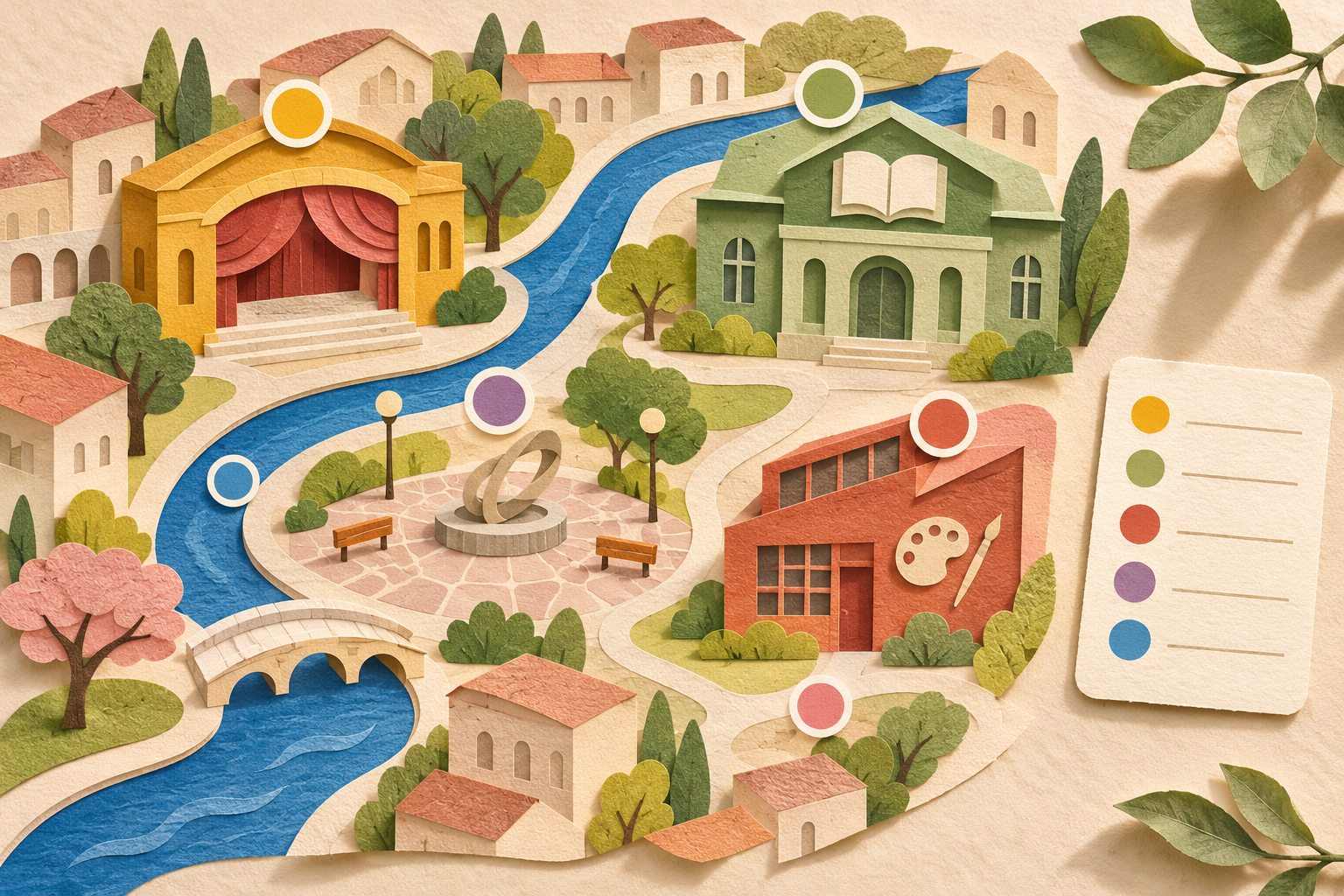
Do not assume blue circles mean libraries or larger symbols mean importance. Size might represent grouped records; colour might simply indicate category. Open the legend and marker description. If a cropped screenshot omits the key, leave symbol interpretation unresolved until you reach the original version.
Also establish whether this is a schematic illustration or a spatial representation with a usable scale. Nearby symbols in an illustration do not establish a short real-world distance. Do not infer walking time or accessibility from an attractive picture, or assume enlarging a fixed screenshot creates additional spatial accuracy.
Separate places, events and records
A building might contain a library and exhibition room, and three events might occur at one venue. Know your counting unit: buildings, organisations, services, events or records. No single answer suits every question. The mistake is changing units between rows, then adding them as independent places.
| Fictional record | What does it represent? | How to treat it in a place inventory |
|---|---|---|
| Centre A | One building hosting several activities | One place with a stable identifier |
| Reading session at Centre A | An event on a specified date | Linked to the place, not an extra building |
| Drawing workshop at Centre A | Another event | A separate event record linked to that place |
| Library B | A different place at another address | A second place once identity is checked |
We have four records, but two places and two events, not four places. Adding an alternative name for Centre A in another language does not create a third place. Store the alternative in a suitable field and link it to the same identifier after checking, rather than automatically merging similar names or duplicating every spelling.
Check filters and clusters before comparing
Suppose a teaching file contains 12 records and a “libraries” filter displays only 5. The other seven disappearing does not mean deletion from the file or real-world closure. Reset filters and check category, area and period before describing a difference between screenshots as a change in the city.
Another example shows a cluster labelled 6 that divides into six points when you zoom in. These are displays of six records, not seven obtained by adding the large marker to the small ones. Whether those six records represent six distinct buildings still requires checking units and identities; the display alone cannot settle that.
Build a small record with traceable sources
For each place retain an identifier, source spelling, clear category, appropriately detailed location, source link and verification date. Separate map-production time from the last review of a particular fact. A technically updated map may contain a description not checked for some time; a page's general date does not establish every item's freshness.
Add status: documented information, needs checking or conflicting sources. If an organisation's page gives a different address from an older record, preserve the reason and date of your change. Do not guess an address because it lies in the expected neighbourhood, or erase the conflict before understanding it.
A learning exercise does not require participants' names or homes. Focus on public-place information appropriate to the question. An online description or picture is not automatically free to copy: retain the link and check reuse conditions before republishing the original. Write your own description without claiming a visit you never made.
Do not treat an empty area as absence of culture
A map represents what was collected through a particular scope and method. An absent place might be outside a category, unrecorded, renamed or in an area with incomplete data. We do not choose any explanation as true without evidence, but an empty screen alone cannot support the verdict.
Marker density also does not equal cultural value or quality of life. Before comparing neighbourhoods, ask about covered area, category definitions, dates and collection methods. The valid comparison may concern “available records in this file”, not the whole of cultural life. Stating those limits makes the result more truthful and reviewable.
A visit plan needs fresh checks beyond the map
A map can introduce a place, but visiting requires the organisation's information about hours, booking and the service you need. Separate the place's existence from a particular event's availability. Do not use an old event date as an upcoming appointment or infer fees and entry availability from a general symbol.
To combine two places, check an actual route using an appropriate method rather than estimating distance visually from a cultural illustration. A marker might identify the building rather than the entrance in use. These are verification questions, not navigation instructions or a guarantee that a route suits a particular person.
Review a map you have made yourself
Begin with a narrow question, such as organising public places whose sources announce reading activities in an imaginary learning area. State inclusion rules, boundaries and work date. Do not call it “all culture in the city” if it covers only one category, or let an ambitious title conceal limited research.
Check every record against its source, then look for duplicate names and addresses. When uncertain, link records with a review note rather than permanently merging them. One organisation may have two branches, or one place two names; similar names do not prove identity and different names do not prove separation.
- Does the title explain subject and boundaries?
- Does the legend explain colour, size and symbols?
- Is the counting unit consistent between places and events?
- Does information have a source and clear verification date?
- Are filters, clusters and duplicates understood?
- Does the conclusion distinguish available records from the wider world?
Keep versions and explain changes
Date versions and briefly record what was added or corrected and why. If a file grows from 8 documented places to 11 after three already-existing places are recorded, documentation expanded. That does not prove three new openings. An opening requires a source supporting the event and its date.
When sharing, include scope, sources and a note that time-sensitive information requires checking again. Do not present a small contribution as endorsed by a scientific organisation or local community. A useful map supports better questions and connects information to places; it does not reduce people's culture to colours or definitive categories.
When translating categories, preserve definitions too. Translating “arts space” as “museum” can change meaning even if the latter sounds more familiar. Choose wording that preserves scope and keep the original name where useful for matching. Do not infer service or audience language from an institution's name; that is a separate fact needing evidence.
For a review exercise, ask someone to select a record and explain how they established category, source and freshness. If they must guess, improve fields and legend before adding points. This checks your file's clarity, not the scientific accuracy of all places. One reading exercise may expose a missing question, but cannot certify completeness.
Sources and limits
The European Commission and National Archives pages were read on 2 November 2026. They support the broad mapping example and identification of map elements; scenarios, table and record workflow are original. No database or actual map was copied. The generated paper scene is imaginary, not a route or measurable scale. This content was prepared with AI assistance and has not received independent human editorial review.