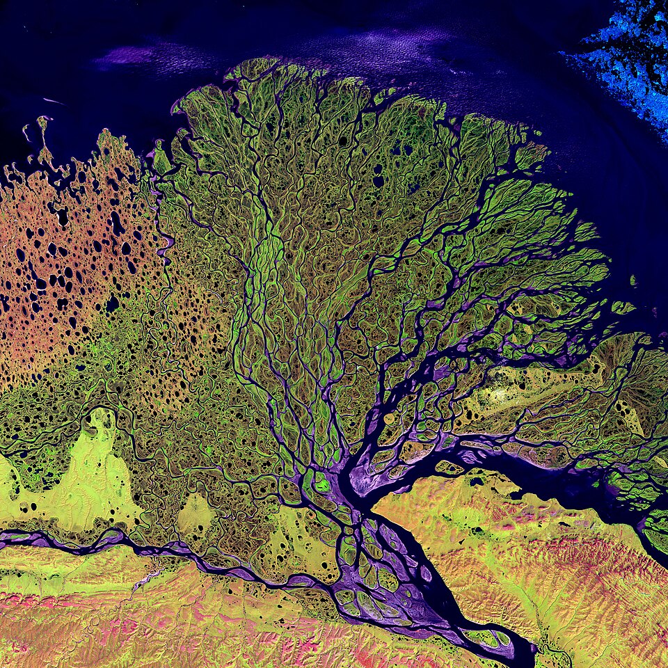
A satellite image may arrive with a confident headline about burned land, missing water or exceptional urban heat. The difficulty may be the leap from colours to a conclusion unsupported by the accompanying information. This guide develops a reading method before sharing or citing imagery; it does not analyse a current event or train readers to perform specialist measurements. It explains observation types, then proposes a practical approach to captions, comparisons and uncertainty. The examples are hypothetical learning exercises, not evidence of an event or responsibility assigned to any party.
Start with scale and location
NASA recommends reading scale, orientation, patterns and colours in the context of a location. Cloud shadows can resemble dark ground features, while vegetation changes with the season. A familiar shape alone therefore establishes neither location nor meaning. Find the original image information, then compare landmarks with an appropriate map and check coverage: a regional scene cannot provide the same detail as a neighbourhood view. Establishing scale first helps prevent an indistinct patch from being described as a particular building or a confirmed event. NASA
Colours do not always represent human vision
NASA explains that false-colour images assign selected measurement bands to display colours. Vegetation can appear red when an infrared band is assigned to the red display channel; red alone does not establish fire. Such combinations reveal differences that visible light may not show clearly. Read the band description and legend before sharing an interpretation. A colour’s meaning in one map cannot simply be transferred to another, and a change in colour presentation is not independent evidence that the ground changed between dates. NASA
Radar is a different observation method
ESA describes radar observations through cloud and during both day and night. This is useful compared with the viewing conditions needed for optical imaging, but it does not turn radar output into an ordinary photograph. Read the product’s processing and interpretation notes rather than imposing expectations about water or building colours. When a report presents a specialised radar-derived result, look for methods and limitations: “observed from space” alone does not explain the measurement or the resulting conclusion. European Space Agency
Surface temperature is not air temperature
NASA distinguishes land surface temperature from the air temperature reported in weather forecasts. A sensor’s observed surface might be a roof, vegetation canopy or ice, so “city temperature” is insufficiently precise. For a thermal map, identify the variable, units and observation time instead of focusing on the hottest colour. If the question concerns the surrounding air, do not present surface measurements as the same quantity. Accurate naming preserves the map’s usefulness and avoids exaggerated comparisons with weather reports measuring something different. NASA
An image represents measurements, not every possible fact
NASA’s remote-sensing introduction explains instruments measuring energy in particular bands and the atmosphere affecting its passage. An image therefore does not contain measurements of every property a reader might want to know. Begin with the product’s intended question and documented variables. Establishing causes, responsibility or social details from a scene requires other suitable evidence. Separating observation from the writer’s interpretation is an editorial discipline, rather than a dismissal of satellite observations and their scientific value. NASA
Smaller display pixels do not create new detail
A technical presentation archived by NASA distinguishes a file’s pixel grid from the sensor’s true spatial resolution. Resampling into a finer grid does not change the instrument that collected the data. Screen magnification cannot establish detail unsupported by the original measurements. Check product documentation instead of judging file size or smooth appearance. If a visually enhanced version is used, distinguish enhancement from a new observation and avoid presenting inferred or processing-added details as original observations confirmed at the location. NASA
Clouds may be the subject or obstruct your question
NASA’s collection of cloud examples illustrates that satellite scenes may depict the atmosphere itself. When asking about ground beneath cloud, explain what is visible and what cannot be seen in that observation. Missing visibility should not become “no change”. If clouds are the subject, use the phenomenon identified by the source instead of guessing from a striking shape. A visually impressive scene remains unsuitable evidence when it cannot answer the question posed by its accompanying text. NASA
Read the layer definition and data history
NASA’s AIRS viewer provides layers with different definitions and products. Some descriptions explain that near-real-time imagery is replaced by a science-quality product when available. Save the layer name, scene date and description instead of retaining an unexplained screenshot. A later difference does not establish deliberate manipulation; processing or layer selection may differ and should be checked before assigning a cause. Preserve the legend and variable description when reusing a view so readers can understand it and trace its source. NASA
Distinguish observations, composites and model contributions
EUMETSAT’s land-surface analysis documentation describes distinct temperature products: clear-sky retrievals, time composites and a product combining observations with model-derived cloudy-sky estimates. These descriptions are not interchangeable. Do not call a product “a photograph taken now” when it covers a period or includes documented calculations. Model use does not invalidate a product, but its method belongs in the explanation. Check product status and version before comparing results; a variable name alone does not describe every processing step. EUMETSAT LSA SAF
Define the question before opening the image
Write a question that can be checked: does this scene show a lake boundary, a thermal variable or a cloud pattern? Beside it, identify the evidence needed to answer. When the question exceeds the available information, narrow it instead of guessing. You might describe a colour difference while withholding its meaning until presentation methods are compared. This suggested editorial exercise makes the article’s limits visible early. It also prevents an expansive headline from pressuring a writer to extract details that the available material does not actually provide.
Create a scene identification card
Record the original publisher link, product name, location, observation date or covered period, units and legend where applicable. Separate the article publication date from the observation date. If information is missing, say it was unavailable in the version reviewed; do not infer it from the social post’s timestamp. Preserve the original description for later checking. This suggested record does not certify the image as true. It makes available and missing information explicit, helping an editor select wording proportionate to the evidence rather than quietly filling gaps.
Hypothetical example: two views of a lake
Imagine a dark-water image and a brightly coloured scene accompanied by a claim that a lake vanished. Before accepting the claim, compare locations, scene boundaries, dates and band definitions. Different presentation methods mean that colour differences alone are insufficient. Where part of the area is not visible, do not turn absence of visibility into a statement about water extent. Explain verified and missing elements, and seek suitable analysis if an area estimate is required. Do not manufacture a precise measurement from a cropped screenshot merely because a viewing program allows drawing over it.
Hypothetical example: a widely shared thermal map
When a post assigns a temperature to a city’s residents, read the layer name first. If it measures surface temperature, correct that description before discussing a value. Check units, time and geographical coverage rather than generalising one coloured patch to the entire city. The defensible article may explain the product while noting that air-temperature questions require appropriate observations. Do not insert a remembered alternative number to complete a headline. Missing relevant measurements justify a narrower conclusion, not an unsupported numerical flourish that sounds informative.
Hypothetical example: differences between versions
If earlier and later views of the same place differ, record layers, observation dates and product versions before alleging manipulation. Look for documentation about preliminary processing, a time composite or altered display choices. These possibilities are not proof of any particular explanation; they define what needs investigation. A request to the producer can describe the difference and link both versions, with the conclusion withheld pending documented clarification. Leaving the question open is more accurate than selecting an appealing cause because the image looks persuasive on a phone screen.
Separate observation and interpretation in writing
Organise notes into the product description, what can be observed in the scene, and points requiring additional evidence. Do not attribute your own next-paragraph conclusion to the scientific organisation. Preserve limitations and possibilities when summarising, rather than converting qualified language into certainty. An article can be useful and confident about its boundaries. Readers need to understand why evidence supports a particular statement, not encounter forceful wording that hides the distance between measurements and political, economic or environmental interpretations attached to them.
Choose a cover that does not imply unrecorded events
An explainer may use a suitable image labelled illustrative or archival, with source and licence information. Do not make an attractive cover appear to prove a current event it did not depict. Explain arrows or cropping when they affect interpretation, retaining access to the original version. Reuse rights and scientific suitability as evidence are separate questions; both need checking before publication. Appearance on a reputable website neither removes the need to read credits nor grants automatic permission to reproduce every third-party item hosted there.
Make a publication decision when information is incomplete
A review may establish that an image explains a concept but cannot support the proposed headline. Publish a narrower documented explanation or hold the claim rather than attaching a categorical conclusion to a general picture. Name the actual limitation: an unknown date, absent layer definition or mismatched comparison. Do not label everything verified when the check only located the image. Good editorial work does not maximise the number of conclusions. It produces an account whose basis readers can trace, including what the material does not yet establish.